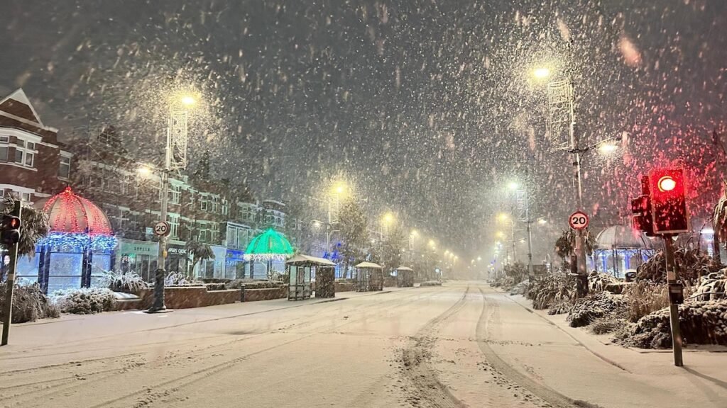
The UK is currently grappling with a severe wave of snow showers that have triggered widespread school closures and prompted both yellow and amber warnings from the Met Office, making the week one of the earliest and most disruptive cold spells of the season. By Thursday, authorities expect up to 25 centimetres of snow in some regions, with temperatures plunging to -11°C in Scotland. These events have created a cascade of effects, particularly across northern parts of the country and central areas, and even as far south as London. Amber and yellow alerts highlight not only the intensity of snowfall but the serious risks to travel, infrastructure, and public safety.
School Closures and Key Affected Regions
The impact on schools has been acute; dozens of institutions in Scotland, Derbyshire, and Gwynedd, Wales, have announced closures, with more expected as conditions deteriorate. Local authorities have directed parents to check council websites for the latest on closures, emphasising regional differences in response protocols. This disruption stems not only from hazardous travel conditions but also from precautionary measures to ensure pupil safety while the wintry weather persists. Schools in the North York Moors, Yorkshire Wolds, and highland regions have been particularly vulnerable, with some headteachers reporting the highest levels of snowfall in years.
Amber and Yellow Weather Warnings Explained
- Amber Warning:
An amber alert is considered a serious warning, indicating a high probability of substantial disruption. This means the public should expect possible road and rail closures, power outages, and even remote communities being cut off. The amber warning for Thursday specifically affects parts of Yorkshire between 5 am and 9pm, with significant snowfall predicted and a risk of blizzard conditions not seen since previous severe winters. - Yellow Warning:
Yellow warnings are issued for somewhat less severe, but still hazardous, weather. In this context, the warning covers much of Wales, northern and central England, and southern Scotland, reflecting both snow and ice risks until late Thursday. These warnings mean travel delays are probable, with untreated roads and cycle paths becoming impassable and an increased likelihood of slips, falls, and mobile service disruptions.
| Warning Type | Key Regions | Disruption Level | Travel Impact |
|---|---|---|---|
| Amber | Yorkshire, Highland | Very High | Major delays, closures |
| Yellow | Wales, N/C England, Scotland | Moderate to High | Delays, icy roads |
Meteorological Insights and Forecast
The cold snap dominating the UK’s weather can be traced to Arctic air descending from the north, producing brisk winds and sharp drops in temperature day and night. Recent days have seen milder weather, making this shift even more pronounced, with daytime highs barely reaching 6-8°C and nighttime temperatures falling below freezing nationwide. The Met Office, through chief forecaster Neil Armstrong, warns of “an early taste of winter weather”, expecting wintry showers to affect especially exposed regions such as Northern Ireland, southwest Wales, northeast England, and northern Scotland.
Unstable, fast-moving showers driven by strong northerly winds create hazardous blizzard-like conditions. Snow accumulations will be greatest above 100 meters of elevation in places like the North York Moors and Yorkshire Wolds, which could receive up to 25cm of snow by Thursday evening. Rural Scotland could see the coldest conditions, with reports of -11°C and the possibility of isolated, impassable roads.
Disruption to Transport and Daily Life
Nationwide, authorities urge caution amid major disruptions to rail, bus, and road travel. National Rail has warned passengers of the worst-case travel delays, urging them to check for cancellations and plan alternative travel arrangements. Power cuts are a real possibility due to heavier snowfall and icy conditions, which are affecting infrastructure and mobile phone coverage. Rural communities risk being cut off, while commuters and travellers are advised to limit journeys and allow extra time for travel.
Hazardous walking conditions on untreated pavements and cycle paths have led to spikes in minor accidents, with emergency services treating more slip-and-fall injuries than usual. Authorities recommend protective clothing, careful route planning, and monitoring local weather often to stay updated about changing conditions.
Public Response and Safety Measures
Local councils and emergency services are working to clear priority routes and support vulnerable residents. The UK Health Security Agency has issued cold-weather alerts and guidance for caring for the elderly, the very young, and others susceptible to cold-related illnesses as temperatures drop. If driving is unavoidable, check road conditions for closures, prepare emergency supplies, and inform someone of your travel plan.
For families, ensuring children’s safety during school closures is critical. Local schools and councils are providing remote learning resources and up-to-date status reports via their websites. The Met Office also recommends checking for updates frequently, as further warnings may be added if the weather worsens through the week.


